Aerial Mapping & Project Documentation Examples
Explore how aerial data can document properties, reveal site conditions, track change, and produce multiple forms of measurable geospatial information
Commercial, industrial, redevelopment, and large-area projects in Southeastern Wisconsin
PROJECT CAPABILITIES
Different Ways Aerial Data Can Support a Project
Interactive Property Mapping
Repeatable Change Documentation
Multiple Geospatial Deliverables
Enhanced Property Documentation
REPEATABLE PROJECT DOCUMENTATION
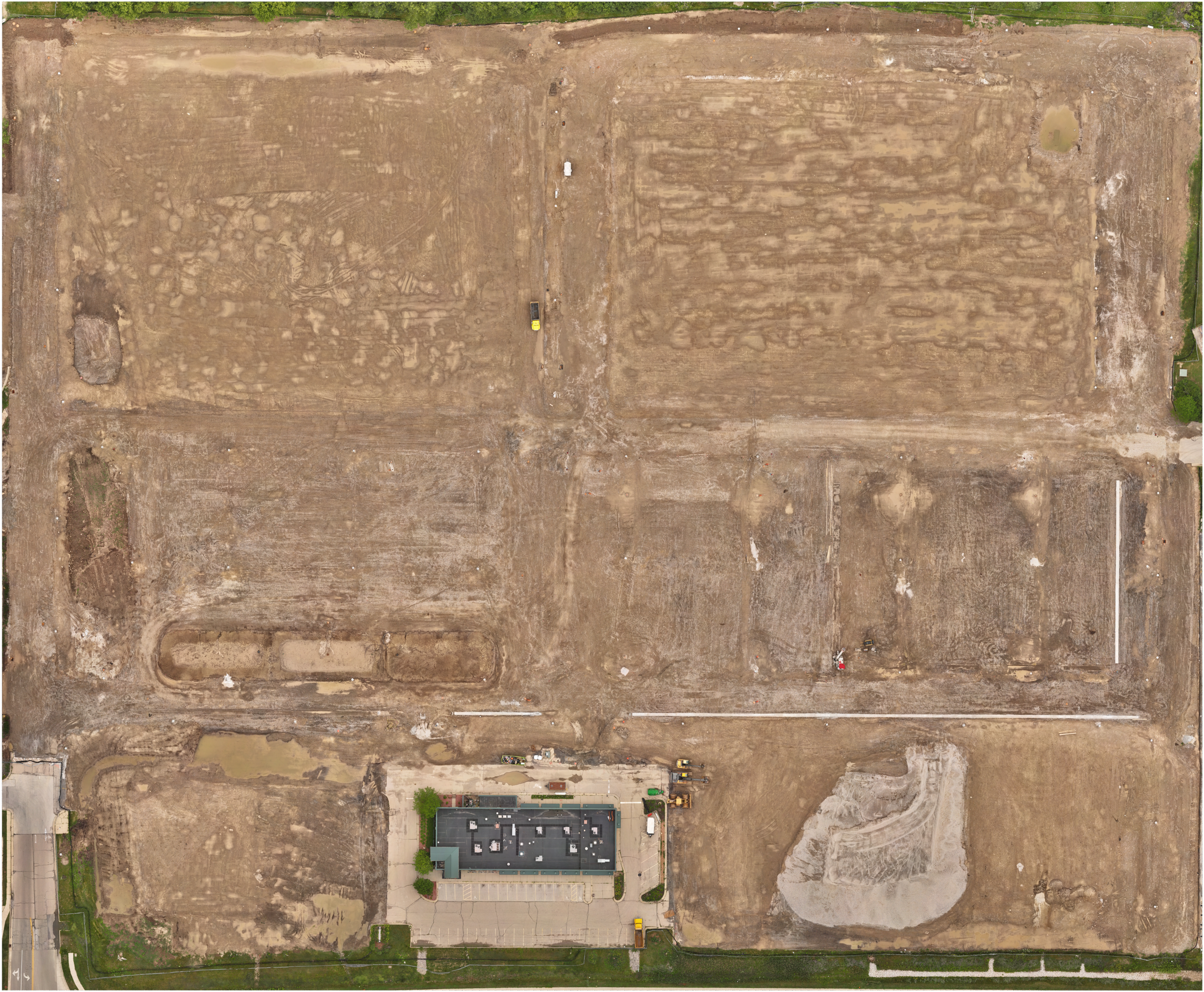
Snapshots In Time
Consistent aerial captures create objective records of a site at different points in time. Repeatable acquisition and processing make it easy to review changing site conditions, document completed work, communicate progress, and maintain a visual record of a project as it evolves. Woodsonia Redevelopment Project – approx. 26 acres – Brown Deer, WI
COMMERCIAL PROPERTY DOCUMENTATION
Explore a Commercial Property in Detail
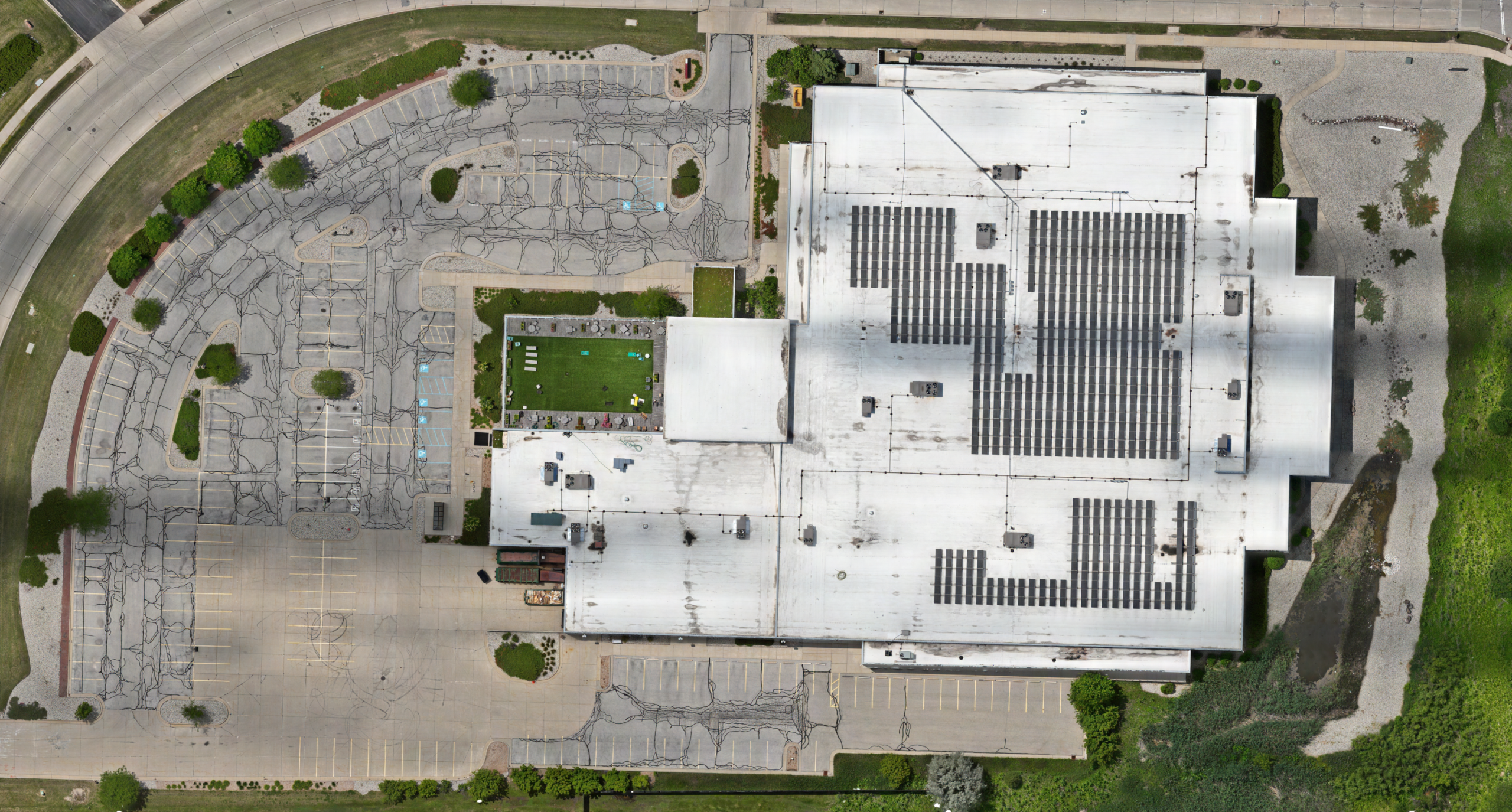
A high-resolution interactive property map provides a detailed, measurable view of an entire commercial site. Visitors can inspect visible site conditions and features, zoom from the full property to individual areas of interest, take distance and area measurements, and place markers to identify locations for review or discussion.
The same type of property documentation can support existing-condition review, property management, acquisition and due-diligence activities, and communication among owners, consultants, contractors, and other project participants.
Commercial Real Estate – approx. 7 acres – Milwaukee, WI
ONE SURVEY • MULTIPLE DELIVERABLES
One Survey - Multiple Perspectives
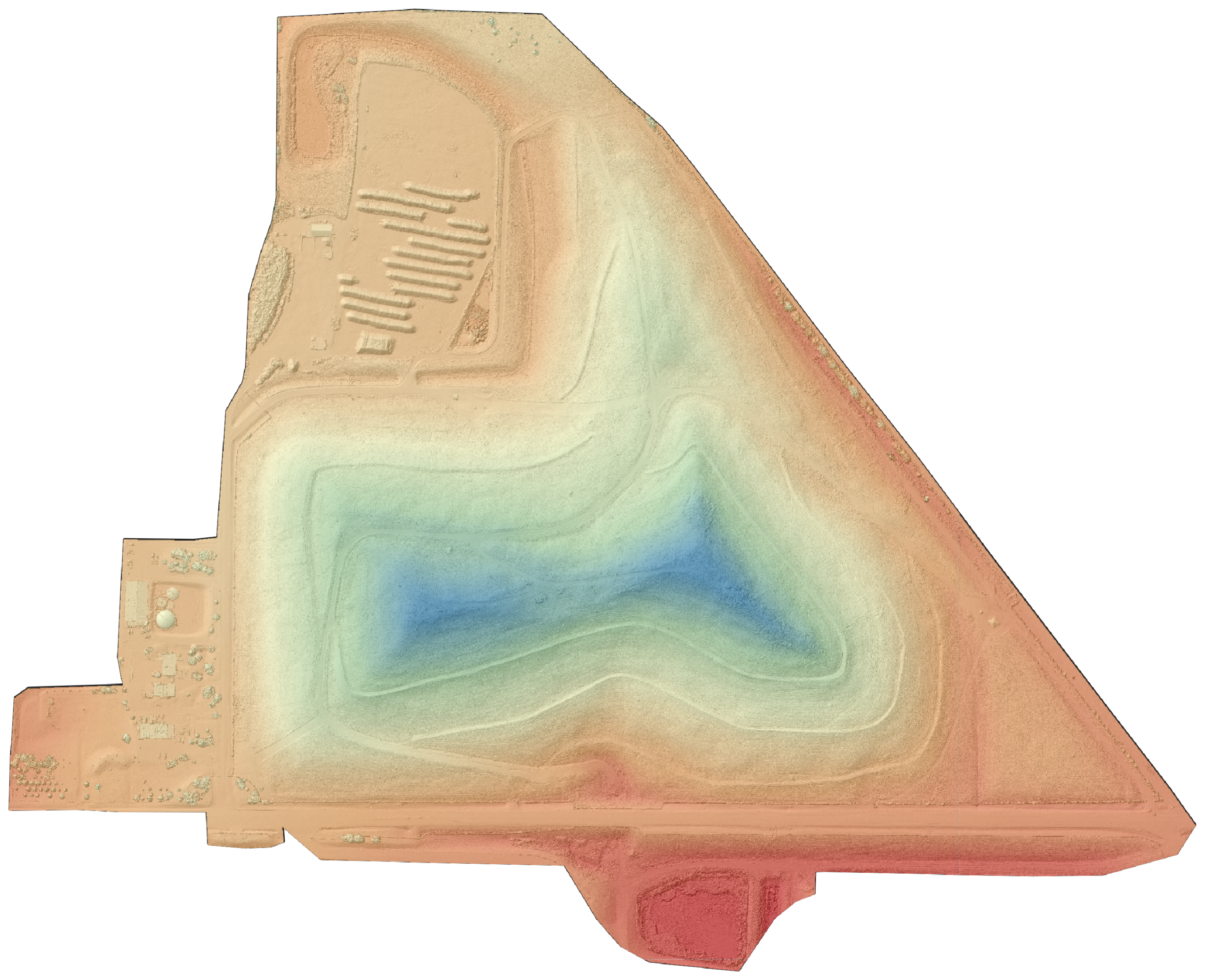
A single aerial survey can produce multiple forms of geospatial information. Orthomosaics, terrain visualizations, contours, and elevation products can be generated from the same captured dataset, providing different perspectives on the same property without additional field collection. Landfill Operation – approx. 120 acres – Germantown, WI
Select each view below to see how the same aerial dataset reveals different aspects of the property.
Color-relief visualization highlighting elevation differences across a landfill.
LARGE-AREA INTERACTIVE MAPPING
Explore an 85-Acre Interactive Site Map
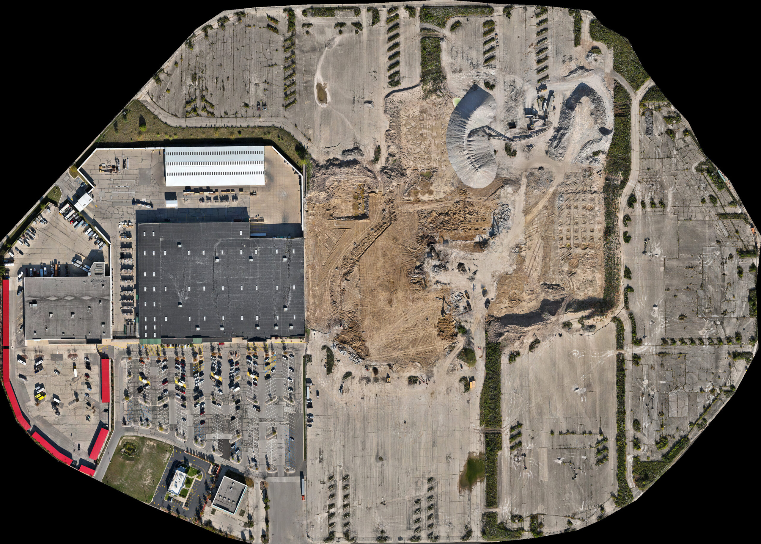
Large properties can be documented as a continuous high-resolution map rather than a collection of disconnected aerial photographs. This approximately 85-acre Milwaukee project provides a detailed, navigable representation of the site for inspection, measurement, and review at multiple scales. Northridge Circle Redevelopment Project – approx. 85 acres – Milwaukee, WI
LOCATION-LINKED PROPERTY DOCUMENTATION
Explore Exterior Imagery in Its Site Context
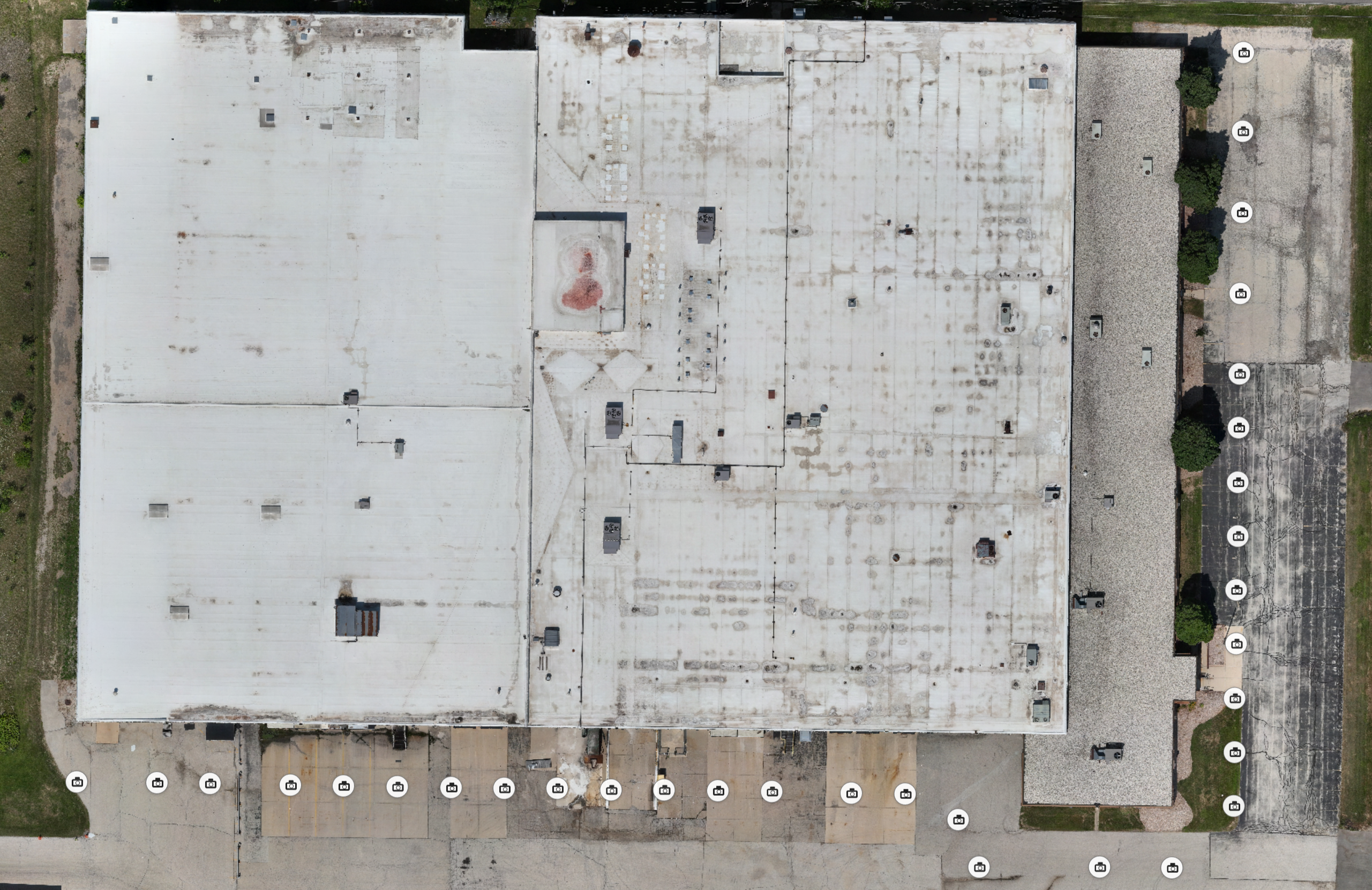
Aerial mapping provides the overall site context while mapped camera positions connect detailed exterior imagery to specific locations around the property. Select a camera position to examine the corresponding façade view, or use façade video to review continuous exterior coverage along the building. Commercial Property — Milwaukee, WI
DISCUSS YOUR PROJECT
Let’s Discuss Your Project
Have a property, site, or project that could benefit from aerial mapping or objective site documentation? Describe what you need to understand, measure, document, or communicate, and Altravar can help determine an appropriate acquisition and deliverable approach.
Based in the Milwaukee area, Altravar provides aerial mapping, property documentation, and UAS data acquisition throughout southeastern Wisconsin, with availability for suitable projects statewide and beyond the immediate region.
FAA Part 107 Certified • Insured Commercial Operations • RTK-Capable Acquisition • Controlled-Airspace Authorization Experience